Custom UTM zones

In Denmark and Sweden (possibly in other countries as well), official maps use UTM - but the zones have been extended.
Sweden extends from UTM zone 32 to 35, but they extend zone 33N to cover the entire area with one projection. The official spec is SWEREF 99 TM (for the transverse mercator projection). My Garmin Inreach mini 2 helpfully supports SWEREF 99 out of the box, and it also allows setting a custom coordinate system, which means I can extend any UTM zone indefinitely.
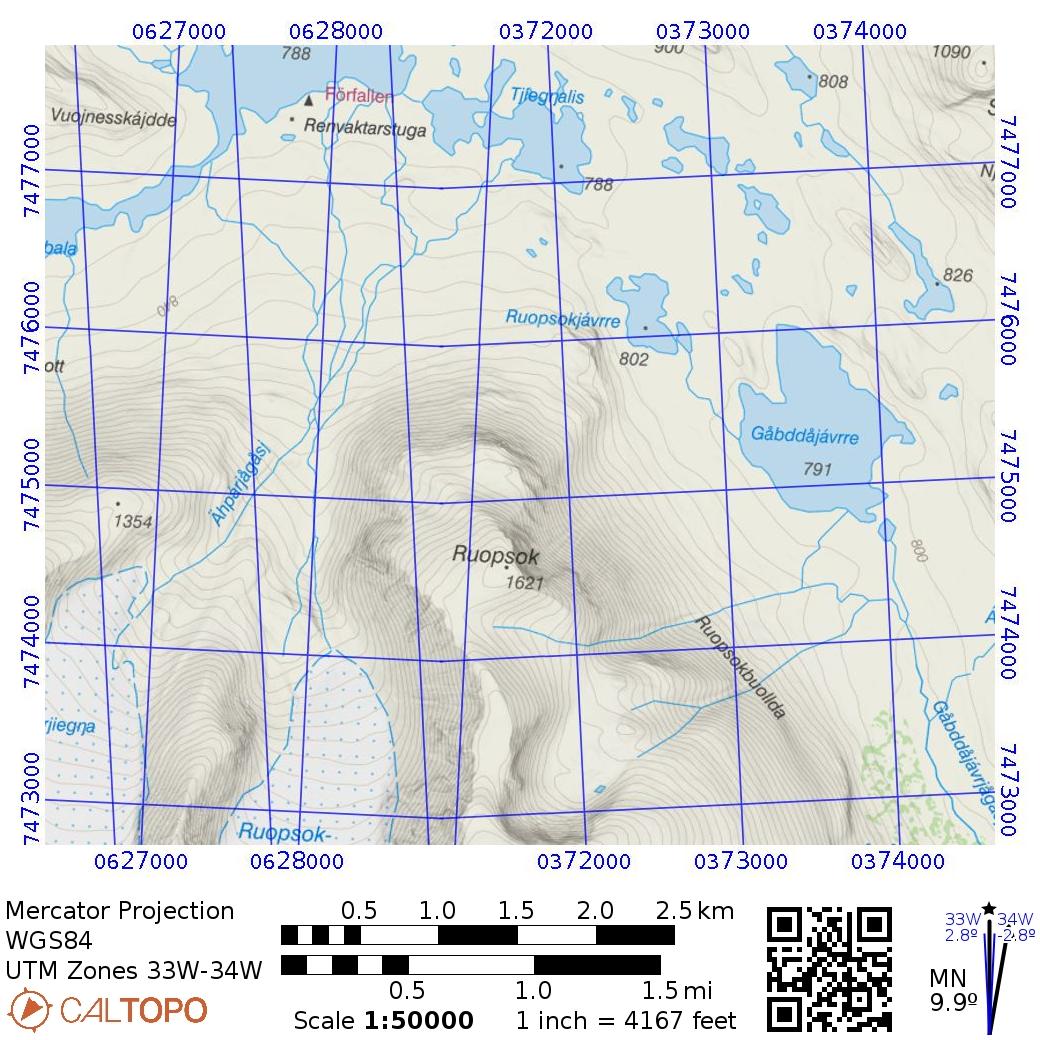
Now, if I want to print a map with gridlines from caltopo, I can't find a way to do anything similar. This means that 1) it looks crazy where the zones meet and 2) getting unambiguous coordinates is unnecesarily hard. Se the image for an example.
Would it be possible to configure this manually for printing?
Comments
0 comments
Please sign in to leave a comment.