superoverlay.kml now limited ESRI resolution?
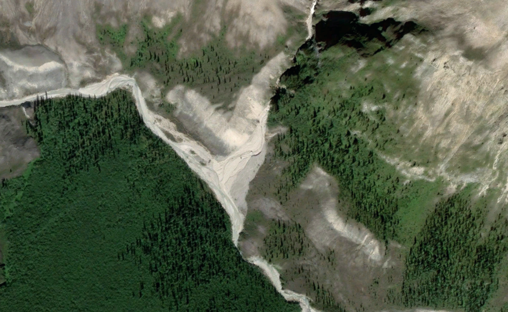
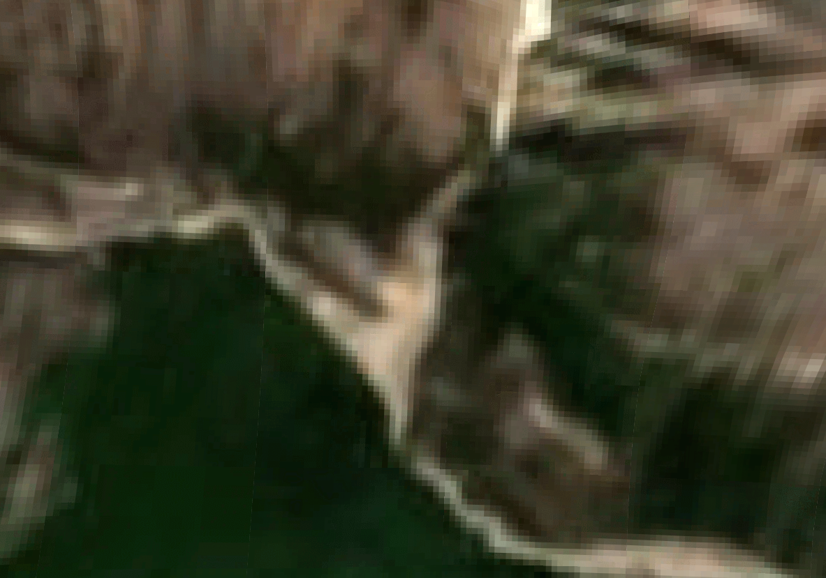
I've been a huge fan of using CalTopo's superoverlay.kml to view layers in Google Earth. I noticed that about a week ago, the Esri Global Imagery layer only imports at very low resolution. Before/After screenshots from within GE are shown below.
Is anyone else seeing this? Did Esri throttle the resolution?
Comments
4 comments
Hi Luc,
The Imagery layer on the KML Super Overlay shows CalTopo’s in house Imagery layer and not a layer from ESRI. We recently updated and refreshed our Imagery layer but unfortunately, due to licensing restrictions with the new imagery data, the resolution in the KML Superoverlay layer decreased outside of the continental US.
Thanks for the explanation—that makes sense. I should have mentioned that I'm working with imagery in Alaska. The imagery layer in the app has always been throttled, unusable up here. CalTopo is outperforming the competition in so many ways, but this is a major shortcoming for your northern users. I hope the licensing limits change someday!
Our recent imagery refresh did add better quality Imagery in Alaska that is currently live on the website. Starting with app version 1.26, which should be out soon, the Alaskan high resolution imagery will be available on the app to view and download!
Ooh! That is very exciting news!
For (non-Continental US) folks who were using the Superoverlay to view CalTopo's imagery in Google Earth, the next best option is to pull directly from Esri with this kmz:
https://services.arcgisonline.com/arcgis/rest/services/World_Imagery/MapServer/kml/mapImage.kmz
Please sign in to leave a comment.