be able to create polygons snapped to parcel boundary lines as well as other base map things
I would like to propose a new feature that I've seen to be very useful in other apps: Be able to create polygons that are snapped to the boundary of parcel property lines.
I see some others requested this a while ago, but let me add to this my suggested implementations and describe my use-cases.
There are several use-cases for this feature. This allows you to show only those specific property boundaries that you are interested on your map - you don't have to turn on parcel overlay (which makes the map crowded with ALL parcel boundaries). You would also then be able to color code your polygons (thus allowing the user to custom color code the boundary polygons for things like "green if I have permission to be on this property" or "blue if the property is county-owned property", etc).
This can be implemented in one of several ways.
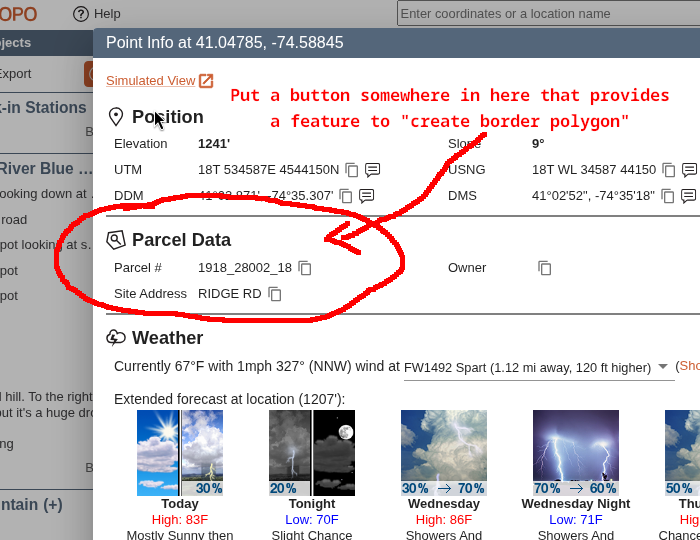
- When viewing the parcel info in the "Point Info" window (the window that shows you Position, Parcel Details, and Weather), provide a button under Parcel Details that says, "Create polygon snapped to border" (see suggested mock-up below)
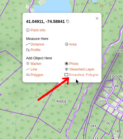
- In the popup window for a point, if the point is within a parcel, provide an link to create "Boundary Polygon" (see suggested mock-up below)
- When creating polygons, you can snap-to different features on the map (this works on desktop only). Add another way to snap-to polygons - parcel property boundary lines. This would have to be limited to desktop only and would require the user to actually manually draw the polygon which is less ideal than the other options.
Comments
1 comment
Hi John -
Agreed that snap-to-parcel would be nice. We tried adding it previously and ran into some performance issues. I'm sure they're solvable, we just need to invest more time into it. Overall we're more likely to focus our efforts on that, than allowing adding a specific parcel's boundary.
- Matt
Please sign in to leave a comment.