High resolution LIDAR Shading?
Feeling really dumb here, but can't find any other threads about this. It seems like there should be higher resolution shading according to this article: https://blog.caltopo.com/2019/12/20/high-resolution-elevation-data/
I'm guessing that this is the "Shaded Relief" overlay option, since I really can't find any shading/LIDAR options elsewhere.
Yet Caltopo's Shaded Relief option is nowhere near the resolution that's available in OR & WA's LIDAR portals. Is this actually the best LIDAR layers available or am I just doing it wrong?
Thanks!
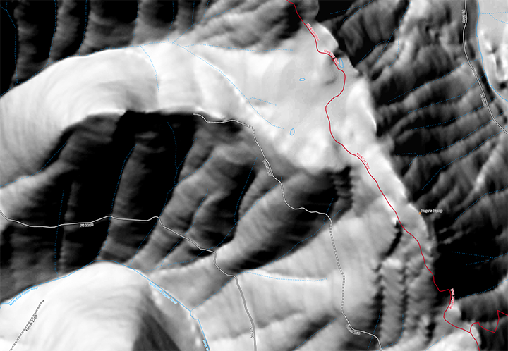
Caltopo Normal Shaded Relief:
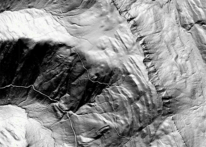
Same location from https://lidarportal.dnr.wa.gov/:
Comments
4 comments
Can you share the coordinates of this location? Or a saved map URL so we can look exactly where this is? You can find an interactive coverage map here: https://caltopo.com/l/CM87.
Sure, and I forgot to mention that I did check the coverage map, and have compared multiple locations in OR & WA.
Coordinates:
46.47070, -121.55534
Hey,
If you check those coordinates on the coverage map I included you will see that the area in question is not yet covered by our data source. https://caltopo.com/l/CM87
Information on our data can be found in the blog here: https://blog.caltopo.com/2022/11/02/latest-high-resolution-elevation-data-update-bring-on-the-snow/.
We are not pulling data from each state until it is all compiled into the USGS data, we feel this leads to more complete, accurate data and coverage for the continental US.
Hahaha, oh I'm so sorry for wasting your time. I was looking at the coverage map and just looked in the wrong spot. And I totally understand the headache of trying to reference multiple state data sources on the backend.
There are a few other locations (Mt Jefferson, Three Fingered Jack) that don't seem to work though, let me know if I'm still being dense. It's especially obvious on Mt Washington:
Another example:
44.41066, -122.12960
Please sign in to leave a comment.