Bug Report: Map glitch creating DEM data error
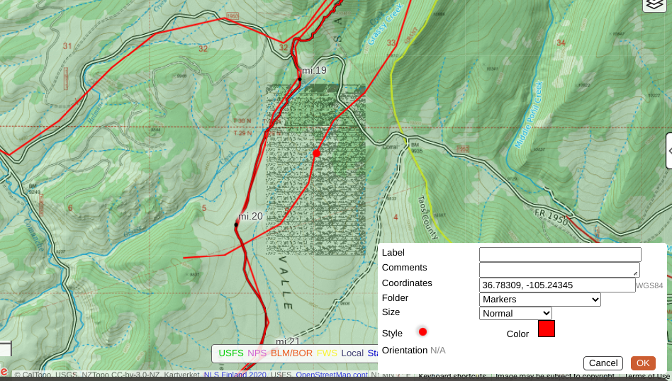
There's a glitch in the matrix, shown below, in the Valle Vidal region of the Carson National Forest in northern New Mexico. The screen shot shows a waypoint for reference. Any track, route, or line that intersects (passes through, even briefly) the glitch region (rectangle shown) produces a wonky and wildly inaccurate elevation profile. The problem is not specific to a certain map or layer. You won't see it until zooming out a few levels.
Comments
2 comments
We are aware of this data error and will work to get this fixed as soon as we can.
Exhibit A. Nothing about this elevation profile is accurate. Although you can accurately guess where the track enters and exits the glitch in the matrix, like a black hole the glitch influences elevation data over a wide arc beyond its visible sphere. Even light or tangible illumination of this particular Caltopo bug can never escape its gravitational pull.
Please sign in to leave a comment.